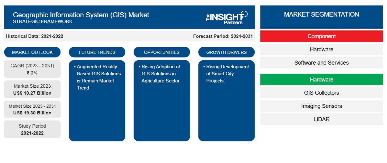
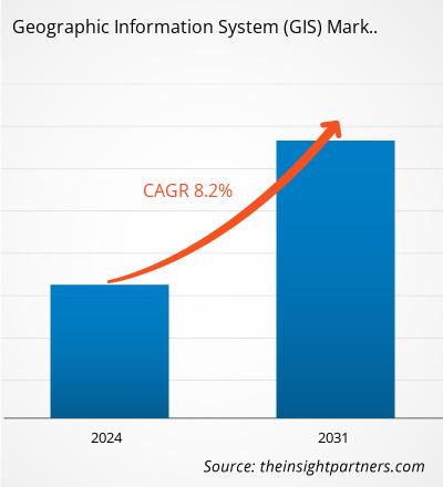
من المتوقع أن يصل حجم سوق نظام المعلومات الجغرافية (GIS) إلى 19.30 مليار دولار أمريكي بحلول عام 2031 من 10.27 مليار دولار أمريكي في عام 2023. ومن المتوقع أن يسجل السوق معدل نمو سنوي مركب بنسبة 8.2٪ من عام 2023 إلى عام 2031. ومن المرجح أن يؤدي إطلاق حلول نظم المعلومات الجغرافية القائمة على الذكاء الاصطناعي وجيل الذكاء الاصطناعي والواقع المعزز إلى جلب اتجاهات جديدة إلى السوق في السنوات القادمة.
تحليل سوق نظم المعلومات الجغرافية (GIS)
من المتوقع أن ينمو سوق نظام المعلومات الجغرافية (GIS) بشكل كبير خلال فترة التنبؤ بسبب الارتفاع في الحاجة إلى التنبؤ بالكوارث الطبيعية. يستخدم نظام المعلومات الجغرافية على نطاق واسع للتنبؤ الدقيق بالعواصف والأعاصير والأمطار الغزيرة. يلعب دورًا مهمًا في التنبؤ بمثل هذه الكوارث الطبيعية والتخفيف من تأثيرها من خلال تقديم البيانات المكانية والصور والتحليلات الأساسية. وفقًا لمنظمات USAFacts، يتم تسجيل أكثر من 65000 كارثة طبيعية في الولايات المتحدة كل عام. تستخدم حكومة الولايات المتحدة حلول نظم المعلومات الجغرافية المتقدمة للتنبؤ بأحداث الكوارث الطبيعية والتنبؤ بها. من عام 1980 إلى عام 2023، سجلت الولايات المتحدة وتكبدت أكثر من 400 كارثة طبيعية متعلقة بالطقس والمناخ، وتجاوزت التكلفة الإجمالية للأضرار 2.78 تريليون دولار أمريكي. في نوفمبر 2024، تم تسجيل حوالي 24 حدثًا مؤكدًا من الكوارث الطبيعية المتعلقة بالطقس والتي تكلفت أكثر من مليار دولار أمريكي. وتشمل هذه الأحداث الطبيعية حريقًا واحدًا، وسبعة عشر حدثًا من العواصف الشديدة، وأربعة أحداث من الأعاصير المدارية، وحدثين من العواصف الشتوية. وعلاوة على ذلك، وفقًا لمنظمة المفوضية الأوروبية، استهلكت حرائق الغابات في جنوب أوروبا 900000 هكتار في عام 2022. كما أحرقت حرائق الغابات في عام 2023 أكثر من 500000 هكتار - في المقام الأول في إيطاليا واليونان وإسبانيا والبرتغال. لتجنب مثل هذه الأحداث الكارثية الطبيعية وتقليل تكلفة الأضرار الإضافية، هناك حاجة متزايدة لأنظمة المعلومات الجغرافية. وبالتالي، فإن الحاجة إلى التنبؤ بالكوارث الطبيعية تغذي نمو سوق أنظمة المعلومات الجغرافية.
يستخدم المزارعون حلول نظم المعلومات الجغرافية لرسم خرائط بيانات الحقول الزراعية وتحليل المحاصيل وتنظيمها ومراقبتها عن بعد. تساعد أنظمة تكامل نظام تحديد المواقع العالمي ونظم المعلومات الجغرافية في جمع البيانات في الوقت الفعلي مثل غلة المحاصيل ومتطلبات المياه في المحاصيل في الحقل الزراعي. يستخدم المزارعون أيضًا حلول نظم المعلومات الجغرافية لتعزيز استخدام الموارد وتحليل أصناف المحاصيل وحدود الحقول ومستويات الارتفاع وأنظمة الري وما إلى ذلك. وبالتالي، من المتوقع أن يوفر التبني المتزايد لحلول نظم المعلومات الجغرافية في قطاع الزراعة فرصًا مربحة لنمو سوق أنظمة المعلومات الجغرافية خلال فترة التنبؤ.
نظرة عامة على سوق نظام المعلومات الجغرافية (GIS)
تُستخدم برامج نظام المعلومات الجغرافية (GIS) لتجميع كميات كبيرة من المعلومات، وتساعد في إدارة البيانات واسترجاعها بطريقة مفيدة. ومن بين المستخدمين النهائيين المختلفين لنظام المعلومات الجغرافية قطاع الخدمات اللوجستية والنقل والزراعة والنفط والغاز والبناء والتعدين والطاقة والمرافق والعديد من الصناعات الأخرى. ويمكن لنظام المعلومات الجغرافية تخزين المعلومات المرجعية جغرافيًا ودمجها وتحريرها ومشاركتها وتحليلها وعرضها. كما يسمح للمستخدمين بإنشاء استعلامات تفاعلية وتحليل خرائط المعلومات المكانية وتحرير البيانات وتقديم نتائج كل هذه العمليات. تُعد تقنية نظام المعلومات الجغرافية أداة أساسية للجمع بين معلومات الاستشعار عن بعد والخرائط المختلفة لتوليد نماذج مختلفة. يُعد برنامج نظام المعلومات الجغرافية حلاً قويًا لعلماء الزراعة لتقديم خدمة أفضل للمزارعين باستخدام البيانات الجغرافية وتنفيذ أنشطة التخطيط لتطوير الزراعة.
قم بتخصيص هذا التقرير ليناسب متطلباتك
ستحصل على تخصيص لأي تقرير - مجانًا - بما في ذلك أجزاء من هذا التقرير، أو تحليل على مستوى الدولة، وحزمة بيانات Excel، بالإضافة إلى الاستفادة من العروض والخصومات الرائعة للشركات الناشئة والجامعات
- احصل على أهم اتجاهات السوق الرئيسية لهذا التقرير.ستتضمن هذه العينة المجانية تحليلاً للبيانات، بدءًا من اتجاهات السوق وحتى التقديرات والتوقعات.
محركات وفرص سوق نظام المعلومات الجغرافية (GIS)
ارتفاع الطلب على الخدمات القائمة على الموقع في الوقت الفعلي في قطاعات الخدمات اللوجستية والنقل والبنية التحتية
قدرت قيمة صناعة الخدمات اللوجستية العالمية بنحو 9.4 تريليون دولار أمريكي في عام 2023 ومن المتوقع أن تصل إلى 9.9 تريليون دولار أمريكي في عام 2024، بمعدل نمو سنوي قدره 5.3٪، وفقًا لتقرير الأمم المتحدة في عام 2022. في قطاع النقل والخدمات اللوجستية، يتم استخدام نظام المعلومات الجغرافية لمراقبة حركة المرور المباشرة وتتبع المركبات في الوقت الفعلي. يوفر نظام المعلومات الجغرافية وظائف المراقبة باستخدام العرض المرئي للبيانات المكانية ويوفر تحديد المواقع الجغرافية الدقيقة في الوقت الفعلي للمركبات التي تتم مراقبتها. كما تُستخدم حلول رسم الخرائط باستخدام نظام المعلومات الجغرافية على نطاق واسع لإنشاء طرق سكك حديدية جديدة وطرق وطرق نقل أخرى. تستمر الاستثمارات في تطوير البنية التحتية للطرق والسكك الحديدية في جميع أنحاء العالم في النمو بسرعة. وفقًا لتقرير توقعات البنية التحتية العالمية، في عام 2023، بلغ استثمار البنية التحتية للنقل العالمي 1.60 تريليون دولار أمريكي. يستخدم نظام المعلومات الجغرافية على نطاق واسع في تحليل وتصور البيانات المكانية أثناء التخطيط للبنية التحتية للنقل وإدارته. إنه يوفر العديد من الفوائد، مثل تحسين الكفاءة وخفض التكاليف والسلامة والاستدامة. وفقًا لمنظمة البنك الدولي، يتألف مشروع جرد الطرق العالمية من أكثر من 60 مجموعة بيانات جغرافية مكانية تتعلق بالبنية التحتية للطرق. تغطي هذه المجموعة من البيانات حوالي 222 دولة وتتضمن خريطة طريق لـ 21 مليون كيلومتر من الطرق. يتم استخدام نظام المعلومات الجغرافية لاستخراج البيانات الجغرافية المكانية لهذه البلدان. وبالتالي، فإن الطلب المرتفع على الخدمات القائمة على الموقع في الوقت الفعلي في قطاعات الخدمات اللوجستية والنقل والبنية التحتية يعزز نمو سوق نظام المعلومات الجغرافية.
تزايد استخدام حلول نظم المعلومات الجغرافية في قطاع الزراعة
تعمل العديد من الجهات الفاعلة الرئيسية في السوق على تطوير حلول نظم المعلومات الجغرافية المتقدمة القائمة على التكنولوجيا لقطاع الزراعة. على سبيل المثال، في يوليو 2024، أطلقت Ecopia AI بيانات جديدة لاستخدام الأراضي الزراعية، والتي تستخدم بيانات المتجهات لاستخراج مستوى جديد من مجموعة بيانات الأراضي الوطنية ثلاثية الأبعاد. تمكن طبقات بيانات المتجهات المخططة هذه الوكالات الحكومية من إجراء تحليلات جغرافية مكانية متعمقة تتعلق بتطوير الأراضي واستخدام المياه وحسابات الجريان السطحي وتقييم الضرائب وتدفقات عمل التحليل التفصيلية الأخرى. في عام 2022، أطلقت الشركة 3D Nationwide Land Cover الذي يوفر 14 طبقة بيانات ثنائية الأبعاد عالية الدقة لرسم خرائط المباني والأشجار والأراضي الزراعية والجسور. في مارس 2024، أطلقت Agribazaar مركز قيادة نظم المعلومات الجغرافية القائم على الذكاء الاصطناعي للمزارعين ومقره في ولاية أوتار براديش بالهند. تم إطلاق المشروع لتصور البيانات الزراعية رقميًا لـ 57000 Gram Panchayats عبر 75 مقاطعة في ولاية أوتار براديش.
في مايو 2024، أطلقت شركة CHC Navigation، وهي شركة تقدم حلول تقنية GNSS، تطبيق MapCloud، وهو أحد حلول GIS المتقدمة لتطبيقات التقاط البيانات ورسم الخرائط لأجهزة Android. يوفر تطبيق MapCloud أدوات قوية لجمع البيانات الميدانية للمهندسين والمساحين والمزارعين ومحترفي GIS عبر مختلف الصناعات.
وبالتالي، فإن الاعتماد المتزايد على حلول نظم المعلومات الجغرافية في قطاع الزراعة من شأنه أن يوفر فرصة لنمو سوق نظم المعلومات الجغرافية.
تقرير تحليل تجزئة سوق نظام المعلومات الجغرافية (GIS)
إن القطاعات الرئيسية التي ساهمت في استنباط تحليل سوق نظام المعلومات الجغرافية (GIS) هي المكون والوظيفة والمستخدم النهائي.
- بحسب المكونات، يتم تقسيم السوق إلى أجهزة وبرامج وخدمات. وقد هيمن قطاع البرامج على السوق في عام 2023.
- بناءً على الوظيفة، يتم تقسيم السوق إلى رسم الخرائط والمسح والاتصالات عن بعد والملاحة والخدمات القائمة على الموقع. هيمن قطاع رسم الخرائط على السوق في عام 2023.
- بناءً على المستخدم النهائي، يتم تقسيم السوق إلى الزراعة والنفط والغاز والبناء والتعدين والنقل والخدمات اللوجستية والطاقة والمرافق وغيرها. هيمن قطاع النقل والخدمات اللوجستية على السوق في عام 2023.
تحليل حصة سوق أنظمة المعلومات الجغرافية (GIS) حسب المنطقة الجغرافية
تم تقسيم سوق نظام المعلومات الجغرافية (GIS) إلى خمس مناطق رئيسية: أمريكا الشمالية وأوروبا وآسيا والمحيط الهادئ (APAC) والشرق الأوسط وأفريقيا (MEA) وأمريكا الجنوبية والوسطى. سيطرت أمريكا الشمالية على السوق في عام 2023، تليها أوروبا ومنطقة آسيا والمحيط الهادئ.
تشهد سوق أنظمة المعلومات الجغرافية (GIS) في أمريكا الشمالية نموًا كبيرًا بسبب العديد من العوامل الرئيسية، بما في ذلك البنية التحتية للمدينة الذكية والتقدم التكنولوجي والتطبيقات المتزايدة عبر الصناعات. تعتمد مبادرات المدينة الذكية في الولايات المتحدة وكندا بشكل كبير على أنظمة المعلومات الجغرافية لإدارة المرافق وأنظمة المرور والخدمات العامة. كما تتخذ حكومات مختلف البلدان في أمريكا الشمالية مبادرات مختلفة لزيادة البنية التحتية للشبكة الذكية في المنطقة. على سبيل المثال، في سبتمبر 2022، استثمرت وزارة الطاقة الأمريكية (DOE) 10.5 مليار دولار أمريكي في برنامج للشبكات الذكية وترقيات أخرى لتعزيز شبكة الكهرباء في البلاد. وبالمثل، كان برنامج GI Smart Grid أحد البرامج الوطنية المستهدفة لوزارة الموارد الطبيعية الكندية التي تعالج البنية التحتية المهمة لتعزيز أهداف الإطار الكندي الشامل بشأن النمو النظيف وتغير المناخ. تم تجديد برنامج الشبكة الذكية في عام 2023. GIS هي تقنية مستخدمة على نطاق واسع للشبكات الذكية التي تمكن من المراقبة المحسنة والنمذجة الدقيقة ودمج البيانات والتخطيط الاستراتيجي والاتصال الفعال.
رؤى إقليمية حول سوق نظام المعلومات الجغرافية (GIS)
لقد قام المحللون في Insight Partners بشرح الاتجاهات والعوامل الإقليمية المؤثرة على سوق نظام المعلومات الجغرافية (GIS) طوال فترة التنبؤ بشكل شامل. يناقش هذا القسم أيضًا قطاعات سوق نظام المعلومات الجغرافية (GIS) والجغرافيا في جميع أنحاء أمريكا الشمالية وأوروبا ومنطقة آسيا والمحيط الهادئ والشرق الأوسط وأفريقيا وأمريكا الجنوبية والوسطى.
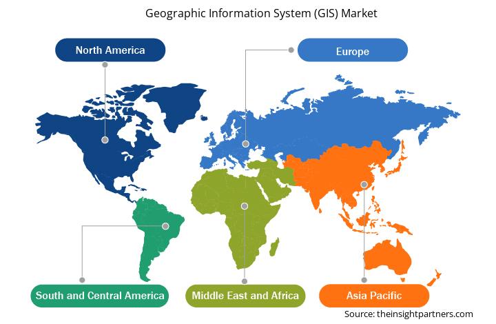
- احصل على بيانات إقليمية محددة لسوق نظام المعلومات الجغرافية (GIS)
نطاق تقرير سوق نظام المعلومات الجغرافية (GIS)
| سمة التقرير | تفاصيل |
|---|---|
| حجم السوق في عام 2023 | 10.27 مليار دولار أمريكي |
| حجم السوق بحلول عام 2031 | 19.30 مليار دولار أمريكي |
| معدل النمو السنوي المركب العالمي (2023 - 2031) | 8.2% |
| البيانات التاريخية | 2021-2022 |
| فترة التنبؤ | 2024-2031 |
| القطاعات المغطاة | حسب المكون
|
| المناطق والدول المغطاة | أمريكا الشمالية
|
| قادة السوق وملفات تعريف الشركات الرئيسية |
|
كثافة اللاعبين في سوق نظام المعلومات الجغرافية (GIS): فهم تأثيرها على ديناميكيات الأعمال
يشهد سوق أنظمة المعلومات الجغرافية (GIS) نموًا سريعًا، مدفوعًا بالطلب المتزايد من المستخدم النهائي بسبب عوامل مثل تفضيلات المستهلكين المتطورة والتقدم التكنولوجي والوعي المتزايد بفوائد المنتج. ومع ارتفاع الطلب، تعمل الشركات على توسيع عروضها والابتكار لتلبية احتياجات المستهلكين والاستفادة من الاتجاهات الناشئة، مما يؤدي إلى زيادة نمو السوق.
تشير كثافة اللاعبين في السوق إلى توزيع الشركات أو المؤسسات العاملة في سوق أو صناعة معينة. وهي تشير إلى عدد المنافسين (اللاعبين في السوق) الموجودين في مساحة سوق معينة نسبة إلى حجمها أو قيمتها السوقية الإجمالية.
الشركات الرئيسية العاملة في سوق نظام المعلومات الجغرافية (GIS) هي:
- شركة أوتوديسك
- شركة توبكون لأنظمة تحديد المواقع
- شركة كاليبر
- شركة سوبر ماب للبرمجيات المحدودة
- سداسي AB
- هدف عالي
إخلاء المسؤولية : الشركات المذكورة أعلاه ليست مرتبة بأي ترتيب معين.
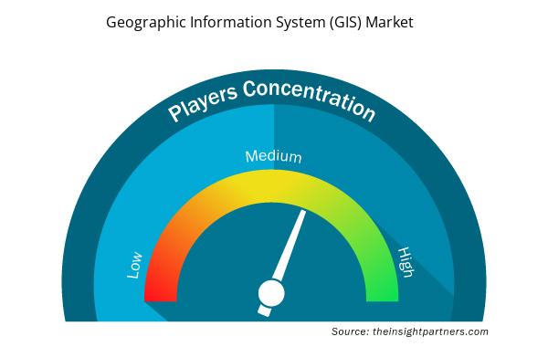
- احصل على نظرة عامة على أهم اللاعبين الرئيسيين في سوق نظام المعلومات الجغرافية (GIS)
أخبار سوق نظم المعلومات الجغرافية والتطورات الأخيرة
يتم تقييم سوق نظام المعلومات الجغرافية (GIS) من خلال جمع البيانات النوعية والكمية بعد البحث الأولي والثانوي، والذي يتضمن منشورات الشركات المهمة وبيانات الجمعيات وقواعد البيانات. فيما يلي بعض التطورات الرئيسية في سوق نظام المعلومات الجغرافية (GIS):
- أعلنت شركة GEO Jobe GIS Consulting، الرائدة في مجال حلول نظم المعلومات الجغرافية، عن شراكة جديدة مع شركة AerialSphere، المزود الرائد لبرامج Oriented Imagery. تمثل هذه الشراكة علامة فارقة في توسيع نطاق تكنولوجيا Oriented Imagery المتطورة من AerialSphere إلى جمهور أوسع داخل مجتمع نظم المعلومات الجغرافية.
(المصدر: AerialSphere، بيان صحفي، يوليو 2024)
- أعلنت شركة Esri، الرائدة عالمياً في تكنولوجيا أنظمة المعلومات الجغرافية (GIS) وذكاء الموقع، عن تعاونها مع شركة Autodesk، Inc. (NASDAQ: ADSK) - الشركة الرائدة عالمياً في تكنولوجيا نمذجة معلومات البناء (BIM) لصناعة الهندسة المعمارية والهندسة والبناء والعمليات (AECO) - لتعزيز تحالفهما الاستراتيجي.
(المصدر: Esri، بيان صحفي، أكتوبر 2024)
تغطية تقرير سوق نظام المعلومات الجغرافية (GIS) والمنتجات النهائية
يوفر "حجم سوق نظام المعلومات الجغرافية (GIS) وتوقعاته (2021-2031)" تحليلاً مفصلاً للسوق يغطي المجالات المذكورة أدناه:
- حجم سوق نظام المعلومات الجغرافية (GIS) وتوقعاته على المستويات العالمية والإقليمية والوطنية لجميع قطاعات السوق الرئيسية التي يغطيها النطاق
- اتجاهات سوق نظام المعلومات الجغرافية (GIS) بالإضافة إلى ديناميكيات السوق مثل المحركات والقيود والفرص الرئيسية
- تحليل مفصل لـ PEST و SWOT
- تحليل سوق نظام المعلومات الجغرافية (GIS) الذي يغطي اتجاهات السوق الرئيسية والإطار العالمي والإقليمي والجهات الفاعلة الرئيسية واللوائح والتطورات الأخيرة في السوق
- تحليل المشهد الصناعي والمنافسة الذي يغطي تركيز السوق، وتحليل خريطة الحرارة، واللاعبين البارزين، والتطورات الأخيرة في سوق نظام المعلومات الجغرافية (GIS)
- ملفات تعريف الشركة التفصيلية
- التحليل التاريخي (سنتان)، السنة الأساسية، التوقعات (7 سنوات) مع معدل النمو السنوي المركب
- تحليل PEST و SWOT
- حجم السوق والقيمة / الحجم - عالميًا وإقليميًا وقطريًا
- الصناعة والمنافسة
- مجموعة بيانات Excel

Report Coverage
Revenue forecast, Company Analysis, Industry landscape, Growth factors, and Trends

Segment Covered
This text is related
to segments covered.

Regional Scope
North America, Europe, Asia Pacific, Middle East & Africa, South & Central America

Country Scope
This text is related
to country scope.
الأسئلة الشائعة
The Geographic Information System (GIS) market was estimated to be valued at US$ 10.27 billion in 2023 and is anticipated to grow at a CAGR of 8.2% over the forecast period.
Rapid development of smart city projects, surge in need for forecasting natural disasters, high demand for real-time location-based services in logistics and transportation and infrastructure sectors are the driving factors of Geographic Information System (GIS) market.
Asia Pacific is anticipated to grow at the fastest CAGR over the forecast period.
Launch of AI, Gen AI, and augmented reality-based GIS Solutions to drive the growth of the Geographic Information System (GIS) market in the coming years.
The key players operating in the Geographic Information System (GIS) market include Autodesk, Inc.; Topcon Positioning Systems, Inc.; Caliper Corporation; SuperMap Software Co., Ltd.; Hexagon AB; Hi-Target; Pitney Bowes Inc.; Maxar Technologies; AmigoCloud, Inc.; Trimble Inc.; Bentley Systems, Incorporated; Cadcorp Limited; Spatialworks Sdn Bhd.; Environmental Systems Research Institute, Inc.; Blue Marble Geographics; Abaco SpA; TomTom International BV; FARO Technologies, Inc.; L3Harris Technologies, Inc.; and Başarsoft Information Technologies Inc..
The Geographic Information System (GIS) market is expected to reach US$ 19.30 billion by 2031.
The software segment led the Geographic Information System (GIS) market with a significant share in 2023.
Trends and growth analysis reports related to Technology, Media and Telecommunications : READ MORE..
The List of Companies - Geographic Information System (GIS) Market
- Autodesk, Inc.
- Topcon Positioning Systems, Inc.
- Caliper Corporation
- SuperMap Software Co., Ltd.
- Hexagon AB
- Hi-Target
- Pitney Bowes Inc.
- Maxar Technologies
- AmigoCloud, Inc.
- Trimble Inc.
- Bentley Systems, Incorporated
- Cadcorp Limited
- Spatialworks Sdn Bhd.
- Environmental Systems Research Institute, Inc.
- Blue Marble Geographics
- Abaco SpA
- TomTom International BV
- FARO Technologies, Inc.
- L3Harris Technologies, Inc.;
- Ba?arsoft Information Technologies Inc.
The Insight Partners performs research in 4 major stages: Data Collection & Secondary Research, Primary Research, Data Analysis and Data Triangulation & Final Review.
- Data Collection and Secondary Research:
As a market research and consulting firm operating from a decade, we have published and advised several client across the globe. First step for any study will start with an assessment of currently available data and insights from existing reports. Further, historical and current market information is collected from Investor Presentations, Annual Reports, SEC Filings, etc., and other information related to company’s performance and market positioning are gathered from Paid Databases (Factiva, Hoovers, and Reuters) and various other publications available in public domain.
Several associations trade associates, technical forums, institutes, societies and organization are accessed to gain technical as well as market related insights through their publications such as research papers, blogs and press releases related to the studies are referred to get cues about the market. Further, white papers, journals, magazines, and other news articles published in last 3 years are scrutinized and analyzed to understand the current market trends.
- Primary Research:
The primarily interview analysis comprise of data obtained from industry participants interview and answers to survey questions gathered by in-house primary team.
For primary research, interviews are conducted with industry experts/CEOs/Marketing Managers/VPs/Subject Matter Experts from both demand and supply side to get a 360-degree view of the market. The primary team conducts several interviews based on the complexity of the markets to understand the various market trends and dynamics which makes research more credible and precise.
A typical research interview fulfils the following functions:
- Provides first-hand information on the market size, market trends, growth trends, competitive landscape, and outlook
- Validates and strengthens in-house secondary research findings
- Develops the analysis team’s expertise and market understanding
Primary research involves email interactions and telephone interviews for each market, category, segment, and sub-segment across geographies. The participants who typically take part in such a process include, but are not limited to:
- Industry participants: VPs, business development managers, market intelligence managers and national sales managers
- Outside experts: Valuation experts, research analysts and key opinion leaders specializing in the electronics and semiconductor industry.
Below is the breakup of our primary respondents by company, designation, and region:

Once we receive the confirmation from primary research sources or primary respondents, we finalize the base year market estimation and forecast the data as per the macroeconomic and microeconomic factors assessed during data collection.
- Data Analysis:
Once data is validated through both secondary as well as primary respondents, we finalize the market estimations by hypothesis formulation and factor analysis at regional and country level.
- Macro-Economic Factor Analysis:
We analyse macroeconomic indicators such the gross domestic product (GDP), increase in the demand for goods and services across industries, technological advancement, regional economic growth, governmental policies, the influence of COVID-19, PEST analysis, and other aspects. This analysis aids in setting benchmarks for various nations/regions and approximating market splits. Additionally, the general trend of the aforementioned components aid in determining the market's development possibilities.
- Country Level Data:
Various factors that are especially aligned to the country are taken into account to determine the market size for a certain area and country, including the presence of vendors, such as headquarters and offices, the country's GDP, demand patterns, and industry growth. To comprehend the market dynamics for the nation, a number of growth variables, inhibitors, application areas, and current market trends are researched. The aforementioned elements aid in determining the country's overall market's growth potential.
- Company Profile:
The “Table of Contents” is formulated by listing and analyzing more than 25 - 30 companies operating in the market ecosystem across geographies. However, we profile only 10 companies as a standard practice in our syndicate reports. These 10 companies comprise leading, emerging, and regional players. Nonetheless, our analysis is not restricted to the 10 listed companies, we also analyze other companies present in the market to develop a holistic view and understand the prevailing trends. The “Company Profiles” section in the report covers key facts, business description, products & services, financial information, SWOT analysis, and key developments. The financial information presented is extracted from the annual reports and official documents of the publicly listed companies. Upon collecting the information for the sections of respective companies, we verify them via various primary sources and then compile the data in respective company profiles. The company level information helps us in deriving the base number as well as in forecasting the market size.
- Developing Base Number:
Aggregation of sales statistics (2020-2022) and macro-economic factor, and other secondary and primary research insights are utilized to arrive at base number and related market shares for 2022. The data gaps are identified in this step and relevant market data is analyzed, collected from paid primary interviews or databases. On finalizing the base year market size, forecasts are developed on the basis of macro-economic, industry and market growth factors and company level analysis.
- Data Triangulation and Final Review:
The market findings and base year market size calculations are validated from supply as well as demand side. Demand side validations are based on macro-economic factor analysis and benchmarks for respective regions and countries. In case of supply side validations, revenues of major companies are estimated (in case not available) based on industry benchmark, approximate number of employees, product portfolio, and primary interviews revenues are gathered. Further revenue from target product/service segment is assessed to avoid overshooting of market statistics. In case of heavy deviations between supply and demand side values, all thes steps are repeated to achieve synchronization.
We follow an iterative model, wherein we share our research findings with Subject Matter Experts (SME’s) and Key Opinion Leaders (KOLs) until consensus view of the market is not formulated – this model negates any drastic deviation in the opinions of experts. Only validated and universally acceptable research findings are quoted in our reports.
We have important check points that we use to validate our research findings – which we call – data triangulation, where we validate the information, we generate from secondary sources with primary interviews and then we re-validate with our internal data bases and Subject matter experts. This comprehensive model enables us to deliver high quality, reliable data in shortest possible time.
 احصل على عينة مجانية لهذا التقرير