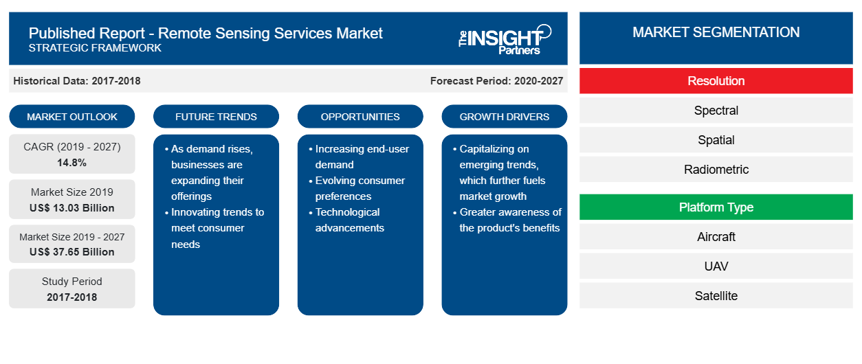
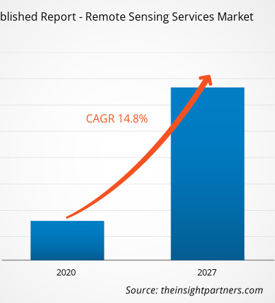
[Research Report] The remote sensing services market was valued at US$ 13,025.5 million in 2019 and is projected to reach US$ 37,650.7 million by 2027; it is expected to grow at a CAGR of 14.8% from 2020 to 2027.
The remote sensing services market is broadly segmented into five major regions—North America, Europe, APAC, MEA, and SAM. North America held the largest share of the market in 2019. Increasing demand for remote sensing services in various sectors, such as oil & gas, mineral exploration, agriculture, energy & power, earth observation, search and rescue, weather forecasting, scientific research, forest industry, and oceanography propels the growth of the remote sensing services market in this region. The US government offers satellite, UAV, manned aircraft, ground, and spatial services to obtain important information for mineral exploration, mapping, resource management, and land-use planning applications. The growing investments in various military and commercial satellites programs are likely to boost the remote sensing services market in North America during the forecast period.
Impact of COVID-19 Pandemic on Remote Sensing Services Market
The COVID-19 pandemic has led to a temporary halt in agricultural activities, urban planning, forestry activities, and so on, since the beginning of 2020. With the imposition of lockdown across various countries in the world, the industries of respective applications have been witnessing declining . Due to low growth in the first quarter of 2020, the remote sensing services market has witnessed slight decline; however, with the resuming businesses in several countries from second and third quarters, the market has been gradually growing.
Due to lower technological developments, the remote sensing service providers have witnessed slow demand from end users such as agriculture, weather, and forest as well as from military forces. This has had a negative impact on the remote sensing services market.
Lucrative Regions in Remote Sensing Services Market

- This FREE sample will include data analysis, ranging from market trends to estimates and forecasts.
- This FREE sample will include data analysis, ranging from market trends to estimates and forecasts.
Market Insights–Remote Sensing Services Market
Diverse Application Areas for Remote Sensing
The remote sensing techniques are being deployed in applications ranging from monitoring urban dynamics—such as urban sprawl, traffic patterns, and land usage changes—to providing assistance for the planning of humanitarian crisis and emergency response. The military forces, agriculture departments, forest departments, and weather forecasting departments are among the chief adopters of remote sensing services. The military forces use satellite images and remote sensing in a broad array of applications, including intelligence, cartography, terrain analysis, battlefield management, military installation management, and terrorist activity monitoring. The broad array of remote sensing applications is accelerating the growth of the service providers.
Resolution Segment Insights
Based on resolution, the spatial segment dominated the remote sensing services market in 2019. Spatial resolution in remote sensing depicts how much detail in the photographic images is visible to the normal human eye. The higher the spatial resolution, greater the details exhibited by the image.
Platform Type Segment Insights
Based on platform type, the satellite segment dominated the remote sensing services market in 2019. Satellite imagery is used for agricultural monitoring around the globe, providing longest operational applications for the Landsat program.
Remote Sensing Services Market, by Platform Type (% share)

- This FREE sample will include data analysis, ranging from market trends to estimates and forecasts.
- This FREE sample will include data analysis, ranging from market trends to estimates and forecasts.
End User Segment Insights
Based on end user, the commercial satellite segment dominated the remote sensing services market in 2019.. Remote sensing has its application in broad areas, including weather, vegetation, forestry, pollution, land use, or erosion. Demand to integrate remote sensing for monitoring and mapping vegetation conditions throughout a range of scales is growing with increasing vegetation.
Customize This Report To Suit Your Requirement
You will get customization on any report - free of charge - including parts of this report, or country-level analysis, Excel Data pack, as well as avail great offers and discounts for start-ups & universities
Published Report - Remote Sensing Services Market: Strategic Insights
- Get Top Key Market Trends of this report.This FREE sample will include data analysis, ranging from market trends to estimates and forecasts.
Customize This Report To Suit Your Requirement
You will get customization on any report - free of charge - including parts of this report, or country-level analysis, Excel Data pack, as well as avail great offers and discounts for start-ups & universities
Published Report - Remote Sensing Services Market: Strategic Insights

- Get Top Key Market Trends of this report.This FREE sample will include data analysis, ranging from market trends to estimates and forecasts.
The players operating in the remote sensing services market focus on new product innovations and developments by integrating advanced technologies and features in their products, which offers them a competitive edge.
- In March 2020, Mallon Technology won the Best Service Category award of GO Awards Northern Ireland 2020. The award is recognized for the excellent customer service provided by the company.
- In January 2019, NorthStar Earth & Space Inc. announced a strategic partnership with SpecTIR Hyperspectral & Remote Sensing Solutions of Reno, Nevada, to deliver complete hyperspectral imaging services. SpecTIR's airborne hyperspectral image services will complement space-based hyperspectral image services delivered by NorthStar, the world's first global information platform to monitor Earth.
- In December 2019, Mallon Technology won the Runners Up award in DM Awards 2019. The award recognized for the Document Capture services.
The global remote sensing services market has been segmented as follows:
Remote Sensing Services Market – by Resolution
- Spectral
- Spatial
- Radiometric
- Temporal
Remote Sensing Services Market– by Platform Type
- Aircraft
- UAV
- Satellite
- Ground
Remote Sensing Services Market – by Platform Type
- Commercial
- Defense
Remote Sensing Services Market- by Region
North America
- US
- Canada
- Mexico
Europe
- France
- Germany
- Italy
- UK
- Russia
- Rest of Europe
Asia Pacific (APAC)
- China
- India
- South Korea
- Japan
- Australia
- Rest of APAC
MEA
- Saudi Arabia
- South Africa
- UAE
- Rest of MEA
SAM
- Brazil
- Argentina
- Rest of SAM
Remote Sensing Services Market – Companies Profiles
- Antrix Corporation Limited
- CyberSWIFT Infotech Pvt. Ltd.
- Geo Sense Sdn. Bhd.
- Mallon Technology
- EKOFASTBA S.L.
- Satellite Imaging Corporation
- Terra Remote Sensing Inc.
- The Airborne Sensing Corporation
- Sanborn Map Company
- SpecTIR
Published Report - Remote Sensing Services Market Regional Insights
The regional trends and factors influencing the Published Report - Remote Sensing Services Market throughout the forecast period have been thoroughly explained by the analysts at Insight Partners. This section also discusses Published Report - Remote Sensing Services Market segments and geography across North America, Europe, Asia Pacific, Middle East and Africa, and South and Central America.
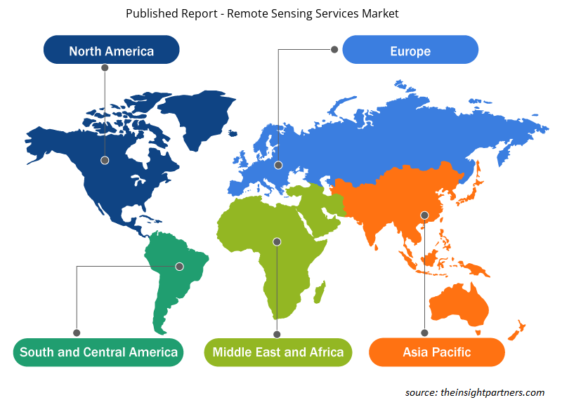
- Get the Regional Specific Data for Published Report - Remote Sensing Services Market
Published Report - Remote Sensing Services Market Report Scope
| Report Attribute | Details |
|---|---|
| Market size in 2019 | US$ 13.03 Billion |
| Market Size by 2027 | US$ 37.65 Billion |
| Global CAGR (2019 - 2027) | 14.8% |
| Historical Data | 2017-2018 |
| Forecast period | 2020-2027 |
| Segments Covered |
By Resolution
|
| Regions and Countries Covered | North America
|
| Market leaders and key company profiles |
Published Report - Remote Sensing Services Market Players Density: Understanding Its Impact on Business Dynamics
The Published Report - Remote Sensing Services Market market is growing rapidly, driven by increasing end-user demand due to factors such as evolving consumer preferences, technological advancements, and greater awareness of the product's benefits. As demand rises, businesses are expanding their offerings, innovating to meet consumer needs, and capitalizing on emerging trends, which further fuels market growth.
Market players density refers to the distribution of firms or companies operating within a particular market or industry. It indicates how many competitors (market players) are present in a given market space relative to its size or total market value.
Major Companies operating in the Published Report - Remote Sensing Services Market are:
- Antrix Corporation Limited
- CyberSWIFT Infotech Pvt. Ltd
- Geo Sense Sdn. Bhd
- Mallon Technology
- EKOFASTBA S.L
Disclaimer: The companies listed above are not ranked in any particular order.
- Get the Published Report - Remote Sensing Services Market top key players overview
- Historical Analysis (2 Years), Base Year, Forecast (7 Years) with CAGR
- PEST and SWOT Analysis
- Market Size Value / Volume - Global, Regional, Country
- Industry and Competitive Landscape
- Excel Dataset

Report Coverage
Revenue forecast, Company Analysis, Industry landscape, Growth factors, and Trends

Segment Covered
Resolution ; Platform Type ; End User

Regional Scope
North America, Europe, Asia Pacific, Middle East & Africa, South & Central America

Country Scope
Argentina, Australia, Brazil, Canada, China, France, Germany, India, Italy, Japan, Mexico, Russian Federation, Saudi Arabia, South Africa, South Korea, United Arab Emirates, United Kingdom, United States
Frequently Asked Questions
The use of remote sensing across the globe is expanding. Ranging from monitoring urban dynamics, such as urban sprawl, traffic patterns, and changes in land use, to providing assistance for the planning of humanitarian crisis & emergency respond—the application areas of remote sensing are widening. For more than 40 years, the Landsat satellites are acquiring images of Earth’s surface. This has turned into the world’s longest constantly-acquired collection of space-based moderate-resolution land remote sensing data. In addition, the National Satellite Land Remote Sensing Data Archive keeps a record of millions of Landsat images about changes in urban land areas across the world. The military forces, agriculture department, forest, and weather forecasting department are among users of remote sensing services. In military, the forces use satellite images and remote sensing in a broad array of applications, including intelligence, cartography, terrain analysis, battlefield management, military installation management, and monitoring of terrorist activity. The use of remote sensing is expected to expand in order to ensure proper functioning of the mentioned applications in the military. Also, with the procurement of unmanned aerial vehicles over manned aerial vehicles, the use of remote sensing would increase as unmanned aerial vehicles can easily reach difficult terrains, where defense forces may not reach. Therefore, military and defense are more inclined toward using unmanned aerial vehicles. In addition, remote sensing also helps aerospace to get plethora of information about missing aircrafts. Numerous satellites orbit the Earth on a regular bases to collect data which can be useful for finding crashed or lost aircraft.
The commercial segment led the market in 2019 with highest share and is expected to continue its dominance during the forecast period. Remote sensing has its application in broad areas, including weather, vegetation, forestry, pollution, land use, or erosion. Companies such as AABSyS provide remote sensing services by generating data to analyze and compare data of the above-mentioned applications. It also offers remote sensing services that are effective for military observation, city planning, archaeological investigations, and more. With constant technological developments, remote sensing is also getting deployed for monitoring an array of remotely detectable properties of vegetation.
In the era of technological advancements, an enormous amount of data gets generated. Big data has various unique characteristics, such as multi-source, high-dimensional, multi-scale, and dynamic-state. Enormous data generated through the atmosphere, agriculture, carbon cycle, environment, Earth surface processes, forest, hydrology, land cover, and ocean need appropriate remote sensing techniques to get real-time imagery accurately. Big data's end user must consider concrete and specific characteristics of remote sensing to extract valuable information and understand the geo-processes. As remote sensing is considered a trusted and important source of information for mapping and monitoring human-made areas and natural land, remote sensing penetration is growing exponentially. In addition to growth of big data and increase in data sensing, urban planning is also among the applications of remote sensing. Spatial data gathered through satellite remote sensing and airborne sensors makes vital contributions toward the massive pool of big data sources, which is used as a backbone for urban-related study. Increasing inclination toward big data would help in extracting information for urban planning and mapping.
Trends and growth analysis reports related to Aerospace and Defense : READ MORE..
The List of Companies - Remote Sensing Services Market
- Antrix Corporation Limited
- CyberSWIFT Infotech Pvt. Ltd
- Geo Sense Sdn. Bhd
- Mallon Technology
- EKOFASTBA S.L
- Satellite Imaging Corporation
- Terra Remote Sensing Inc
- The Airborne Sensing Corporation
- The Sanborn Map Company, Inc
- SpecTIR
 Get Free Sample For