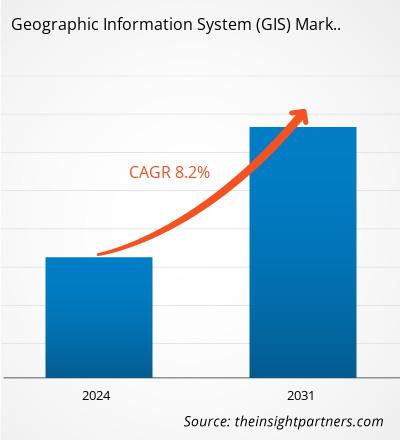
The geographic information system (GIS) market size is expected to reach US$ 19.30 billion by 2031 from US$ 10.27 billion in 2023. The market is estimated to record a CAGR of 8.2% from 2023 to 2031. The launch of AI, Gen AI, and augmented reality-based GIS solutions is likely to bring new trends to the market in the coming years.
Geographic Information System (GIS) Market Analysis
The geographic information system (GIS) market is predicted to grow considerably during the forecast period due to the surge in the need for forecasting natural disasters. Geographic information system is widely used for the accurate forecasting of storms, hurricanes, and excessive rains. It plays an important role in predicting and mitigating the impact of such natural disaster events by offering essential spatial data, images, and analysis. According to the USAFacts Organizations, in the US, more than 65,000 natural disasters are recorded every year. The US government uses advanced GIS solutions to predict and forecast natural disaster events. From 1980 to 2023, the US recorded and sustained more than 400 weather and climate-related natural disasters, and the overall damage cost exceeded US$ 2.78 trillion. In November 2024, ~24 confirmed weather-related natural disaster events were recorded that cost more than US$ 1 billion. These natural events include one wildfire event, seventeen severe storm events, four tropical cyclone events, and two winter storm events. Further, according to the European Commission Organization, in Southern Europe, wildfires consumed 900,000 hectares in 2022. Also, in 2023, wildfires burned more than 500,000 hectares—primarily in Italy, Greece, Spain and Portugal. To avoid such natural disaster events and reduce the additional damage cost, there is a growing requirement for geographic information systems. Thus, the need for forecasting natural disasters fuels the geographic information system market growth.
Farmers use GIS solutions to map agriculture field data and analyze, organize, and monitor crops remotely. GPS and GIS integration systems help collect real-time data such as crops yield, water requirement in the crops in the agriculture field. Farmers also use GIS solutions to boost resource utilization and analyze crop varieties, field boundaries, elevation levels, irrigation systems, etc. Thus, the increasing adoption of GIS solutions in the agriculture sector is expected to offer lucrative opportunities for the geographic information system market growth during the forecast period.
Geographic Information System (GIS) Market Overview
A geographic information system (GIS) software is used to synthesize large amounts of information, and it helps manage and retrieve data in a useful manner. Various end users of GIS are logistics and transportation, agriculture, oil and gas, construction, mining, energy and utilities, and many other industries. GIS can store, integrate, edit, share, analyze, and display geographically referenced information. It allows users to create interactive queries, analyze spatial information maps, edit data, and present the results of all these operations. GIS technology is an essential tool for combining various remote sensing information and maps to generate various models. GIS software is a powerful solution for agricultural scientists to provide better service to farmers by using geographic data and implementing planning activities for the development of agriculture.
Customize This Report To Suit Your Requirement
You will get customization on any report - free of charge - including parts of this report, or country-level analysis, Excel Data pack, as well as avail great offers and discounts for start-ups & universities
Geographic Information System (GIS) Market: Strategic Insights
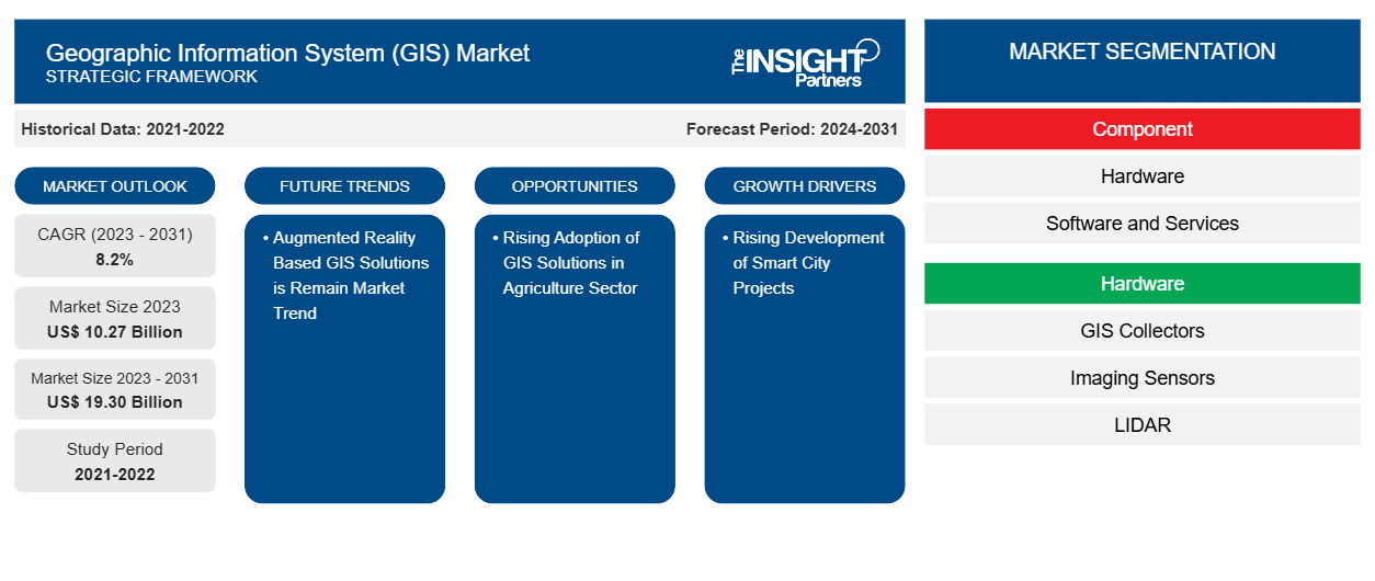
- Get Top Key Market Trends of this report.This FREE sample will include data analysis, ranging from market trends to estimates and forecasts.
Customize This Report To Suit Your Requirement
You will get customization on any report - free of charge - including parts of this report, or country-level analysis, Excel Data pack, as well as avail great offers and discounts for start-ups & universities
Geographic Information System (GIS) Market: Strategic Insights

- Get Top Key Market Trends of this report.This FREE sample will include data analysis, ranging from market trends to estimates and forecasts.
Geographic Information System (GIS) Market Drivers and Opportunities
High Demand for Real-Time Location-Based Services in Logistics and Transportation and Infrastructure Sectors
The global logistics industry was valued at ~US$ 9.4 trillion in 2023 and is expected to reach US$ 9.9 trillion in 2024, with an annual growth rate of 5.3%, according to the United Nations Report in 2022. In the transportation and logistics sector, geographic information system is used for live traffic monitoring and real-time vehicle tracking. GIS offers monitoring functions using visual display of the spatial data and provides precise geographical real-time positioning of monitored vehicles. Also, GIS mapping solutions are widely used to create new railway routes, roadways, and other transportation routes. Investments in the infrastructure development of roadways and railways across the globe continue to grow rapidly. According to the Global Infrastructure Outlook Report, in 2023, the global transportation infrastructure investment reached US$ 1.60 trillion. Geographic information system is widely used in the analysis and visualization of spatial data while planning transportation infrastructure and management. It provides several benefits, such as improved efficiency, cost reduction, and safety and sustainability. According to the World Bank Organization, the Global Roads Inventory Project consists of more than 60 geospatial datasets related to road infrastructure. This dataset covers around 222 countries and includes a roadmap of 21 million km of roads. A geographic information system is used to extract the geospatial data of these countries. Thus, the high demand for real-time location-based services in logistics and transportation and infrastructure sectors boosts the growth of the geographic information system market.
Rising Adoption of GIS Solutions in Agriculture Sector
Several major players in the market are developing advanced technology-based GIS solutions for the agriculture sector. For instance, in July 2024, Ecopia AI launched new agricultural land use data, which uses vector data to extract a new level of the 3D Nationwide Land dataset. These planimetric vector data layers enable government agencies to perform in-depth geospatial analytics related to land development, water usage, runoff calculations, tax assessment, and other detailed analysis workflows. In 2022, the company launched a 3D Nationwide Land Cover that provides 14 high-precision 2D data layers for mapping buildings, trees, agricultural land, and bridges. In March 2024, Agribazaar launched an AI-based GIS Command Centre for farmers based in Uttar Pradesh, India. The project was launched to digitally visualize the agricultural data for 57,000 Gram Panchayats across 75 districts of Uttar Pradesh.
In May 2024, CHC Navigation, a provider of GNSS technology solutions, launched MapCloud, which is one of the advanced GIS solutions for data capture and mapping applications for Android devices. This MapCloud delivers powerful field data collection tools for engineers, surveyors, farmers, and GIS professionals across various industries.
Thus, the rising adoption of GIS solution in the agriculture sector will offer opportunity for the geographic information system market growth.
Geographic Information System (GIS) Market Report Segmentation Analysis
Key segments that contributed to the derivation of the geographic information system (GIS) market analysis are component, function, and end user.
- By component, the market is segmented into hardware, software, and services. The software segment dominated the market in 2023.
- Based on function, the market is segmented into mapping, surveying, telematics and navigation, and location-based services. The mapping segment dominated the market in 2023.
- Based on end user, the market is segmented into agriculture, oil and gas, construction, mining, transportation and logistics, energy and utilities, and others. The transportation and logistics segment dominated the market in 2023.
Geographic Information System (GIS) Market Share Analysis by Geography
The geographic information system (GIS) market is segmented into five major regions: North America, Europe, Asia Pacific (APAC), the Middle East & Africa (MEA), and South & Central America. North America dominated the market in 2023, followed by Europe and APAC.
The North America geographic information system (GIS) market is growing significantly due to several key factors, including smart city infrastructure, technological advancements, and increasing applications across industries. Smart city initiatives in the US and Canada heavily depend on GIS to manage utilities, traffic systems, and public services. Also, governments of various countries in North America are taking various initiatives to increase the smart grid infrastructure in the region. For instance, in September 2022, the US Department of Energy (DOE) invested US$ 10.5 billion in a program for smart grids and other upgrades to strengthen the country's electricity grid. Similarly, the GI Smart Grid Program was one of Natural Resource Canada's targeted national programs addressing significant infrastructure to advance the goals of the Pan Canadian Framework on clean growth and climate change. The Smart Grid Program was renewed in 2023. GIS is a widely used technology for smart grids that enables enhanced monitoring, accurate modeling, data integration, strategic planning, and effective communication.
Geographic Information System (GIS) Market Regional Insights
The regional trends and factors influencing the Geographic Information System (GIS) Market throughout the forecast period have been thoroughly explained by the analysts at Insight Partners. This section also discusses Geographic Information System (GIS) Market segments and geography across North America, Europe, Asia Pacific, Middle East and Africa, and South and Central America.
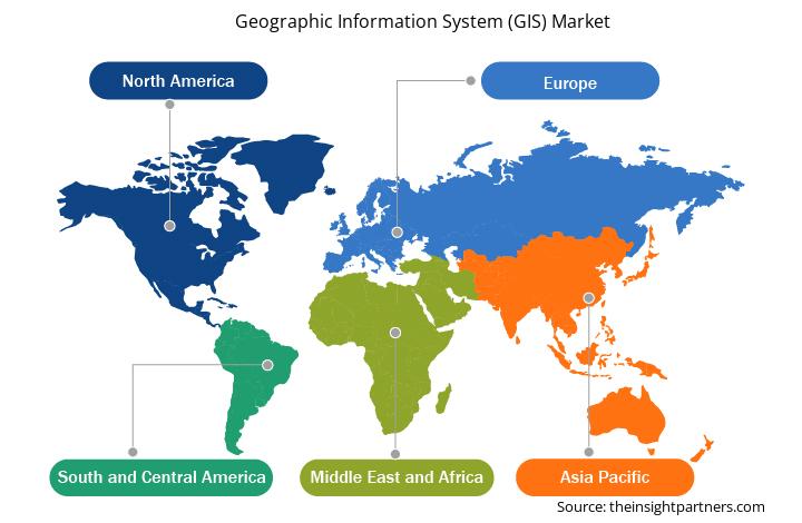
- Get the Regional Specific Data for Geographic Information System (GIS) Market
Geographic Information System (GIS) Market Report Scope
| Report Attribute | Details |
|---|---|
| Market size in 2023 | US$ 10.27 Billion |
| Market Size by 2031 | US$ 19.30 Billion |
| Global CAGR (2023 - 2031) | 8.2% |
| Historical Data | 2021-2022 |
| Forecast period | 2024-2031 |
| Segments Covered |
By Component
|
| Regions and Countries Covered | North America
|
| Market leaders and key company profiles |
Geographic Information System (GIS) Market Players Density: Understanding Its Impact on Business Dynamics
The Geographic Information System (GIS) Market market is growing rapidly, driven by increasing end-user demand due to factors such as evolving consumer preferences, technological advancements, and greater awareness of the product's benefits. As demand rises, businesses are expanding their offerings, innovating to meet consumer needs, and capitalizing on emerging trends, which further fuels market growth.
Market players density refers to the distribution of firms or companies operating within a particular market or industry. It indicates how many competitors (market players) are present in a given market space relative to its size or total market value.
Major Companies operating in the Geographic Information System (GIS) Market are:
- Autodesk, Inc.
- Topcon Positioning Systems, Inc.
- Caliper Corporation
- SuperMap Software Co., Ltd.
- Hexagon AB
- Hi-Target
Disclaimer: The companies listed above are not ranked in any particular order.
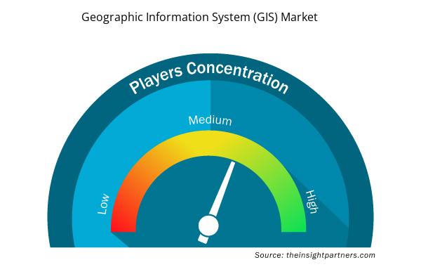
- Get the Geographic Information System (GIS) Market top key players overview
Geographic Information System (GIS) Market News and Recent Developments
The geographic information system (GIS) market is evaluated by gathering qualitative and quantitative data post primary and secondary research, which includes important corporate publications, association data, and databases. A few of the key developments in the geographic information system (GIS) market are listed below:
- GEO Jobe GIS Consulting, a renowned leader in GIS solutions, announced a new reseller partnership with AerialSphere, the premier provider of Oriented Imagery software. This partnership marks a milestone in expanding the reach of AerialSphere's cutting-edge Oriented Imagery technology to a broader audience within the GIS community.
(Source: AerialSphere, Press Release, July 2024)
- Esri, the global leader in geographic information system (GIS) technology and location intelligence, collaborated with Autodesk, Inc. (NASDAQ: ADSK)—a global leader in building information modeling (BIM) technology for the architecture, engineering, construction, and operations (AECO) industry—are enhancing their strategic alliance.
(Source: Esri, Press Release, October 2024)
Geographic Information System (GIS) Market Report Coverage and Deliverables
The "Geographic Information System (GIS) Market Size and Forecast (2021–2031)" provides a detailed analysis of the market covering the areas mentioned below:
- Geographic information system (GIS) market size and forecast at global, regional, and country levels for all the key market segments covered under the scope
- Geographic information system (GIS) market trends as well as market dynamics such as drivers, restraints, and key opportunities
- Detailed PEST and SWOT analysis
- Geographic information system (GIS) market analysis covering key market trends, global and regional framework, major players, regulations, and recent market developments
- Industry landscape and competition analysis covering market concentration, heat map analysis, prominent players, and recent developments for the geographic information system (GIS) market
- Detailed company profiles
- Historical Analysis (2 Years), Base Year, Forecast (7 Years) with CAGR
- PEST and SWOT Analysis
- Market Size Value / Volume - Global, Regional, Country
- Industry and Competitive Landscape
- Excel Dataset

Report Coverage
Revenue forecast, Company Analysis, Industry landscape, Growth factors, and Trends

Segment Covered
This text is related
to segments covered.

Regional Scope
North America, Europe, Asia Pacific, Middle East & Africa, South & Central America

Country Scope
This text is related
to country scope.
Frequently Asked Questions
The Geographic Information System (GIS) market was estimated to be valued at US$ 10.27 billion in 2023 and is anticipated to grow at a CAGR of 8.2% over the forecast period.
Rapid development of smart city projects, surge in need for forecasting natural disasters, high demand for real-time location-based services in logistics and transportation and infrastructure sectors are the driving factors of Geographic Information System (GIS) market.
Asia Pacific is anticipated to grow at the fastest CAGR over the forecast period.
Launch of AI, Gen AI, and augmented reality-based GIS Solutions to drive the growth of the Geographic Information System (GIS) market in the coming years.
The key players operating in the Geographic Information System (GIS) market include Autodesk, Inc.; Topcon Positioning Systems, Inc.; Caliper Corporation; SuperMap Software Co., Ltd.; Hexagon AB; Hi-Target; Pitney Bowes Inc.; Maxar Technologies; AmigoCloud, Inc.; Trimble Inc.; Bentley Systems, Incorporated; Cadcorp Limited; Spatialworks Sdn Bhd.; Environmental Systems Research Institute, Inc.; Blue Marble Geographics; Abaco SpA; TomTom International BV; FARO Technologies, Inc.; L3Harris Technologies, Inc.; and Başarsoft Information Technologies Inc..
The Geographic Information System (GIS) market is expected to reach US$ 19.30 billion by 2031.
The software segment led the Geographic Information System (GIS) market with a significant share in 2023.
Trends and growth analysis reports related to Technology, Media and Telecommunications : READ MORE..
The List of Companies - Geographic Information System (GIS) Market
- Autodesk, Inc.
- Topcon Positioning Systems, Inc.
- Caliper Corporation
- SuperMap Software Co., Ltd.
- Hexagon AB
- Hi-Target
- Pitney Bowes Inc.
- Maxar Technologies
- AmigoCloud, Inc.
- Trimble Inc.
- Bentley Systems, Incorporated
- Cadcorp Limited
- Spatialworks Sdn Bhd.
- Environmental Systems Research Institute, Inc.
- Blue Marble Geographics
- Abaco SpA
- TomTom International BV
- FARO Technologies, Inc.
- L3Harris Technologies, Inc.;
- Ba?arsoft Information Technologies Inc.
 Get Free Sample For