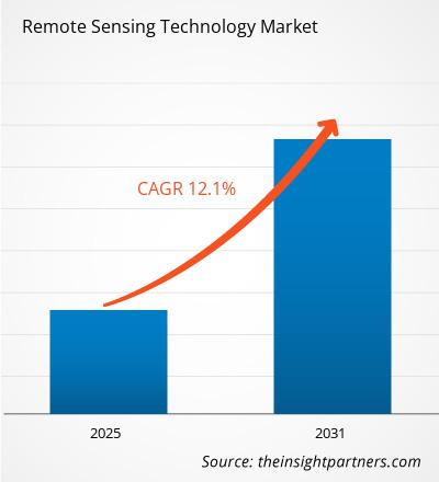
The remote sensing technology market is expected to register a CAGR of 12.1% during 2023–2031. The rise of cubesats for earth observation and advancements in light detection and ranging (LiDAR) technology is likely to remain a key trend in the market.
Remote Sensing Technology Market Analysis
- The remote sensing technology market includes growth prospects owing to the current market trends and their foreseeable impact during the forecast period.
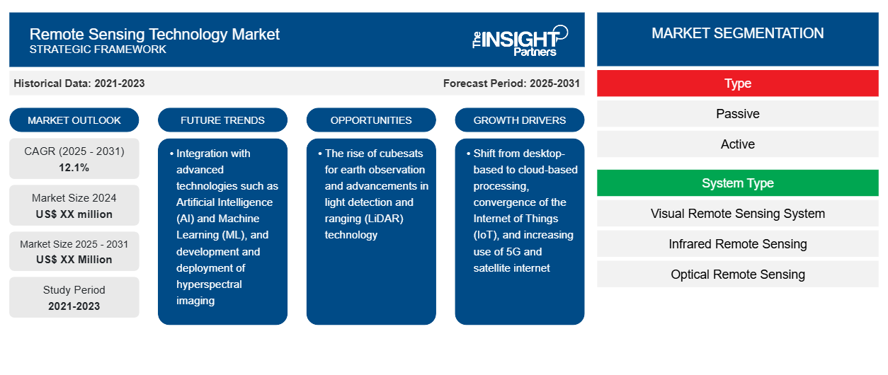
- The remote sensing technology market is growing owing to factors such as the shift from desktop-based to cloud-based processing, convergence of the Internet of Things (IoT), and increasing use of 5G and satellite internet.
- Integration with advanced technologies such as Artificial Intelligence (AI) and Machine Learning (ML), and development and deployment of hyperspectral imaging to provide lucrative opportunities for the remote sensing technology market.
Remote Sensing Technology Market Overview
- Remote sensing is a type of geospatial technology that samples emitted and reflected electromagnetic (EM) radiation from the Earth’s terrestrial, atmospheric, and aquatic ecosystems for detecting and monitoring an area's physical properties by measuring its reflected and emitted radiation at a distance without making physical contact.
- Sensor technologies that are either passive or active are commonly used in this remote sensing data collecting, and they are based on satellites and aircraft.
- The majority of earth sciences, such as meteorology, geology, hydrology, ecology, oceanography, glaciology, geography, and land surveying, as well as applications in the military, intelligence, commercial, economic, planning, and humanitarian fields, are among the thousands of use cases and disciplines in which remote sensing technology is used.
Customize This Report To Suit Your Requirement
You will get customization on any report - free of charge - including parts of this report, or country-level analysis, Excel Data pack, as well as avail great offers and discounts for start-ups & universities
Remote Sensing Technology Market: Strategic Insights
- Get Top Key Market Trends of this report.This FREE sample will include data analysis, ranging from market trends to estimates and forecasts.
Customize This Report To Suit Your Requirement
You will get customization on any report - free of charge - including parts of this report, or country-level analysis, Excel Data pack, as well as avail great offers and discounts for start-ups & universities
Remote Sensing Technology Market: Strategic Insights

- Get Top Key Market Trends of this report.This FREE sample will include data analysis, ranging from market trends to estimates and forecasts.
Remote Sensing Technology Market Drivers and Opportunities
Shift From Desktop-Based To Cloud-Based Processing to Favor Market
- Cloud computing has many benefits, including cost-effectiveness, accessibility, scalability, and teamwork. Users may access and analyze remote sensing data from a variety of sources and formats, use sophisticated algorithms and machine learning, and share and visualize the results online due to cloud platforms like Google Earth Engine, Amazon Web Services, and Microsoft Azure.
- The integration of remote sensing data with other geospatial data and applications, like web mapping, geocoding, and spatial analysis, is also made easier due to cloud computing.
Development And Deployment Of Hyperspectral Imaging
- Hyperspectral imaging is a powerful technology combining spectroscopy with imaging capability. It enables to collection of comprehensive data in a manner that is not feasible with traditional imaging technologies regarding the make-up and properties of surfaces and objects.
- Hyperspectral imaging sensors are able to record hundreds of small electromagnetic radiation bands ranging from the visible to the infrared. High spectral detail and resolution offered by hyperspectral imaging enable the detection and categorization of objects and features that traditional multispectral sensors are unable to detect.
- Numerous fields can benefit from hyperspectral imaging, including urban planning, vegetation mapping, mineral exploitation, and water quality evaluation.
Remote Sensing Technology Market Report Segmentation Analysis
Key segments that contributed to the derivation of the remote sensing technology market analysis are type, system type, and application.
- By type, the market is bifurcated into passive and active.
- By system type, the market is segmented into visual remote sensing systems, infrared remote sensing, optical remote sensing, microwave remote sensing, radar remote sensing, and others.
- By application, the market is segmented into landscape assessment, security, air quality, hydrology, forestry, floodplain mapping, emergency management, and others.
Remote Sensing Technology Market Share Analysis by Geography
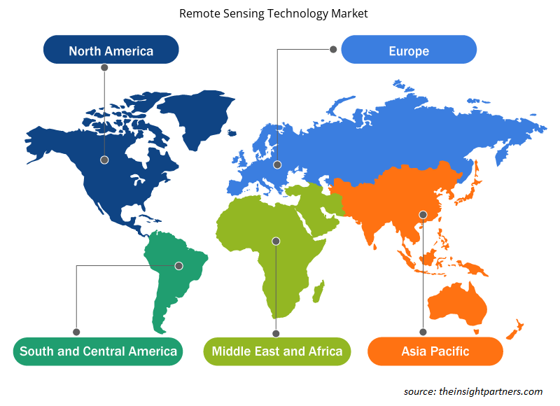
- Remote sensing technology market report comprises a detailed analysis of five major geographic regions, which includes current and historical market size and forecasts for 2021 to 2031, covering North America, Europe, Asia-Pacific (APAC), Middle East and Africa (MEA), and South & Central America.
- Each region is further sub-segmented into respective countries. This report provides analysis and forecasts of 18+ countries, covering remote sensing technology market dynamics such as drivers, trends, and opportunities that are impacting the markets at the regional level.
- Also, the report covers PEST analysis, which involves the study of major factors that influence the remote sensing technology market in these regions.
Remote Sensing Technology Market Regional Insights
The regional trends and factors influencing the Remote Sensing Technology Market throughout the forecast period have been thoroughly explained by the analysts at Insight Partners. This section also discusses Remote Sensing Technology Market segments and geography across North America, Europe, Asia Pacific, Middle East and Africa, and South and Central America.
- Get the Regional Specific Data for Remote Sensing Technology Market
Remote Sensing Technology Market Report Scope
| Report Attribute | Details |
|---|---|
| Market size in 2024 | US$ XX million |
| Market Size by 2031 | US$ XX Million |
| Global CAGR (2025 - 2031) | 12.1% |
| Historical Data | 2021-2023 |
| Forecast period | 2025-2031 |
| Segments Covered |
By Type
|
| Regions and Countries Covered | North America
|
| Market leaders and key company profiles |
Remote Sensing Technology Market Players Density: Understanding Its Impact on Business Dynamics
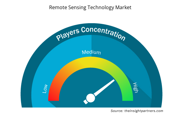
The Remote Sensing Technology Market market is growing rapidly, driven by increasing end-user demand due to factors such as evolving consumer preferences, technological advancements, and greater awareness of the product's benefits. As demand rises, businesses are expanding their offerings, innovating to meet consumer needs, and capitalizing on emerging trends, which further fuels market growth.
Market players density refers to the distribution of firms or companies operating within a particular market or industry. It indicates how many competitors (market players) are present in a given market space relative to its size or total market value.
Major Companies operating in the Remote Sensing Technology Market are:
- Maxar Technologies
- Esri.
- General Dynamics Mission Systems, Inc.
- Hexagon AB
- Lockheed Martin Corporation.
- Orbital Insight
Disclaimer: The companies listed above are not ranked in any particular order.
- Get the Remote Sensing Technology Market top key players overview
Remote Sensing Technology Market News and Recent Developments
The remote sensing technology market is evaluated by gathering qualitative and quantitative data post primary and secondary research, which includes important corporate publications, association data, and databases. A few of the developments in the remote sensing technology market are listed below:
- According to the China Aerospace Science and Technology Corporation, China successfully launched a Long March 2D carrier rocket, deploying a new remote-sensing satellite into orbit. The rocket lifted off at 7:45 am from the Xichang Satellite Launch Center in Sichuan province and successfully delivered the Yaogan 42B satellite to its designated orbit. (China Aerospace Science and Technology Corporation, Press Release, April 2024).
- Sentera, a leading provider of advanced sensing solutions, is pleased to announce a strategic partnership with Dynatech Innovations, a premier technology distributor based in the United Arab Emirates. This collaboration marks a significant milestone in Sentera’s global expansion strategy and aims to bring state-of-the-art sensor technology to a broader market across multiple sectors. Under the terms of the partnership, Dynatech will serve as an authorized distributor of Sentera’s comprehensive range of sensors and imaging systems throughout the Middle East. This alliance will leverage Dynatech’s robust distribution network and deep understanding of regional market needs, ensuring that Sentera’s innovative products reach more industries, including agriculture, construction, environmental monitoring, and more. (Sentera, Press Release, May 2024).
Remote Sensing Technology Market Report Coverage and Deliverables
The “Remote Sensing Technology Market Size and Forecast (2021–2031)” report provides a detailed analysis of the market covering below areas:
- Remote sensing technology market size and forecast at global, regional, and country levels for all the key market segments covered under the scope
- Remote sensing technology market trends, as well as market dynamics such as drivers, restraints, and key opportunities
- Detailed PEST/Porter’s Five Forces and SWOT analysis
- Remote sensing technology market analysis covering key market trends, global and regional framework, major players, regulations, and recent market developments
- Industry landscape and competition analysis covering market concentration, heat map analysis, prominent players, and recent developments for the remote sensing technology market
- Detailed company profiles
- Historical Analysis (2 Years), Base Year, Forecast (7 Years) with CAGR
- PEST and SWOT Analysis
- Market Size Value / Volume - Global, Regional, Country
- Industry and Competitive Landscape
- Excel Dataset

Report Coverage
Revenue forecast, Company Analysis, Industry landscape, Growth factors, and Trends

Segment Covered
This text is related
to segments covered.

Regional Scope
North America, Europe, Asia Pacific, Middle East & Africa, South & Central America

Country Scope
This text is related
to country scope.
Frequently Asked Questions
The rise of cubesats for earth observation and advancements in light detection and ranging (LiDAR) technology is anticipated to play a significant role in the global remote sensing technology market in the coming years.
The global remote sensing technology market is expected to grow at a CAGR of 12.1% during the forecast period 2024 - 2031.
The leading players operating in the remote sensing technology market are Maxar Technologies; Esri.; General Dynamics Mission Systems, Inc.; Hexagon AB; Lockheed Martin Corporation.; Orbital Insight; Planet Labs PBC; Northrop Grumman; Raytheon Technologies Corporation; and Thales Group
The report can be delivered in PDF/PPT format; we can also share excel dataset based on the request.
Some of the customization options available based on the request are an additional 3–5 company profiles and a country-specific analysis of 3–5 countries of your choice. Customizations are to be requested/discussed before making final order confirmation, as our team would review the same and check the feasibility.
Shift from desktop-based to cloud-based processing, convergence of the Internet of Things (IoT), and increasing use of 5G and satellite internet are the major factors driving the remote sensing technology market.
Trends and growth analysis reports related to Technology, Media and Telecommunications : READ MORE..
The List of Companies
1. General Dynamics Corp.
2. GEOSYS
3. Honeywell International Inc.
4. ITT Inc.
5. Leica Geosystems Holdings AG
6. Lockheed Martin Corporation
7. Lumasense Technologies, Inc. (Advanced Energy)
8. Northrop Grumman Corporation
9. Raytheon Technologies Corporation
10. Thales Group
 Get Free Sample For